

Notice: This is an old unsupported web page that may be discontinued at any time, the Improved Java Version of this map is available.
Or, to view all the currently available resources, please navigate the site from the La Jolla Surfing main page.
Notes:
- Maps of Southern California and Northern California are also available to help see through much of the clutter above.
- In addition, a Java Buoy Summary is available.
- The NOAA Moored buoy data wind direction is now plotted from the new text field format in degrees rather than from a table of angles (N, NW, etc., etc.).
- Missing data: This occurs from time to time as data is unavailable from CDIP or NOAA. It will usually reappear within a few hours. Check the NOAA NDBC Buoy Status for detailed information on the status of any NOAA moored buoy.
- NDBC Station Maintenance Update – check here for the latest on the vanishing NOAA buoys.
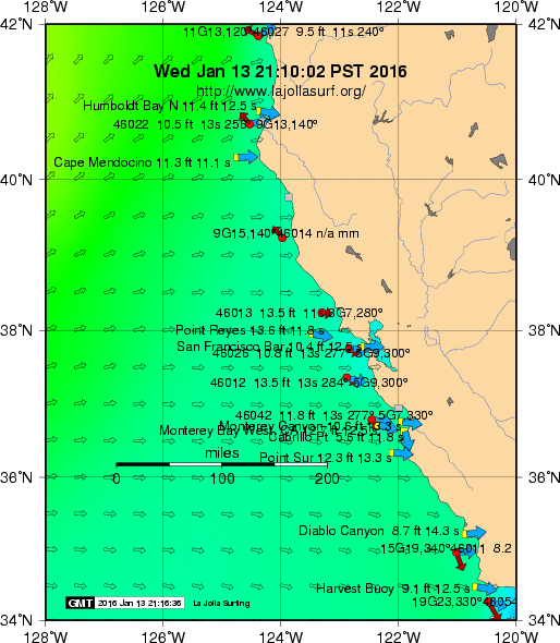
- The red circles represent the NOAA moored buoys. The yellow squares represent CDIP buoys/stations, and the green diamond CICESE in Mexico. When directional data are present, a blue arrow is drawn showing the mean swell direction for the CDIP stations at Santa Cruz, Diablo Canyon, Harvest Buoy, Huntington Beach, and San Clemente. The mean wave angle for the Harvest platform is indicated by the large light blue arrow in the lower left of the map. The sustained wind is plotted with a dark red vector indicating direction – 1/10 inch is 10 knots. In summary, blue arrows represent the observed average direction and green arrows the predicted direction.
- A PostScript version of the current image is also available.
- Data is compiled and plotted twice per hour courtesy: